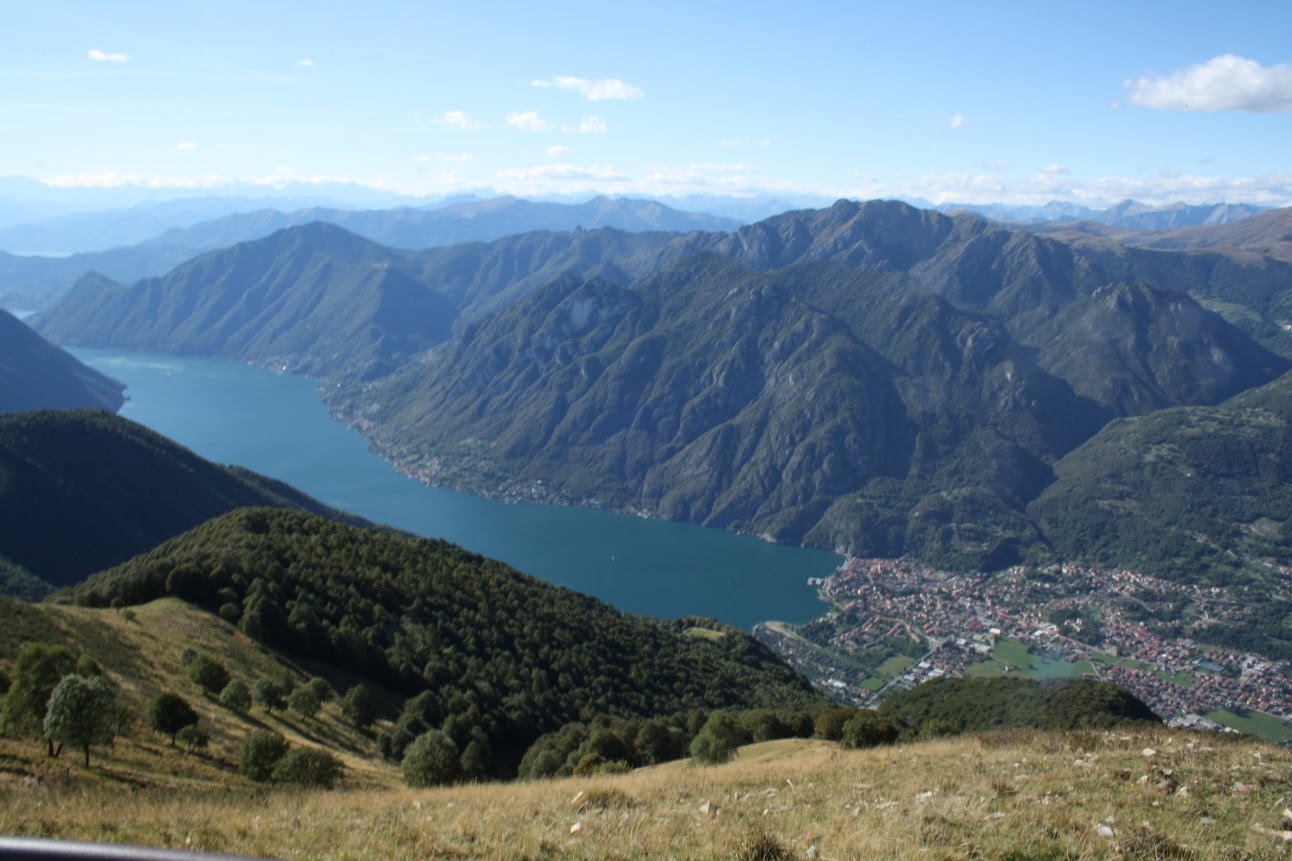
The spectacular view of Lake Como from Pigra.
The border with Switzerland runs along the crest of the mountains above the western shores of the lake. The border was fortified in the past with a series of garrison posts for the Guardia di Finanza to try to control the main economic activity of the area – smuggling. Most of these barracks have now been converted into ‘rifugi’ offering food and accommodation for hikers. Whilst the latter is undoubtedly basic, the former can achieve the sublime heights of traditional cuisine. These rifugi provide the opportunity to undertake a prolonged hike extending over two or more days. Here is the account of the two day trip taken by my brother and I in late summer. We started out from Argegno arriving there on the C10 bus from Como and ending up in Tremezzo (although our original intention was to reach Menaggio) and returning home on the lake.
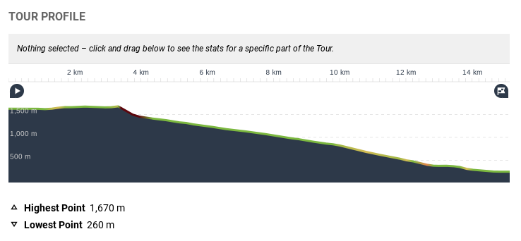
This walk is not particularly strenuous following as it does the old military road along the defensive Cadorna line. This road with its impressive defences was constructed during the Great War to discourage an invasion from Swiss territory. The effort required by the young soldiers to engineer the trenches and gun emplacements at an altitude ranging from 1000 to 1700 metres must have been massive. While this road’s defensive value was never put to the test, its legacy is to leave a singularly pleasant and well-tended hiking path for future generations to exploit.
This route was our original intention but after overnighting at the Rifugio Venini at the summit of Monte Galbiga, we deviated towards Monte Crocione.
Our walk forms a section of the ‘Via dei Monti Lariani’ which starts from the summit of Monte Bisbino above Cernobbio to the Torre Nuovo above Sorico – a total distance of 124 kilometres. Thus there is ample scope to extend the hike beyond a mere two days with rifugi strategically placed along the route for food and accommodation. Extending a hike beyond a brief excursion only serves to magnify the pleasures derived from trekking on Lake Como’s mountains.
Looking down on Pigra and the diagonal fold of the Val D’Intelvi
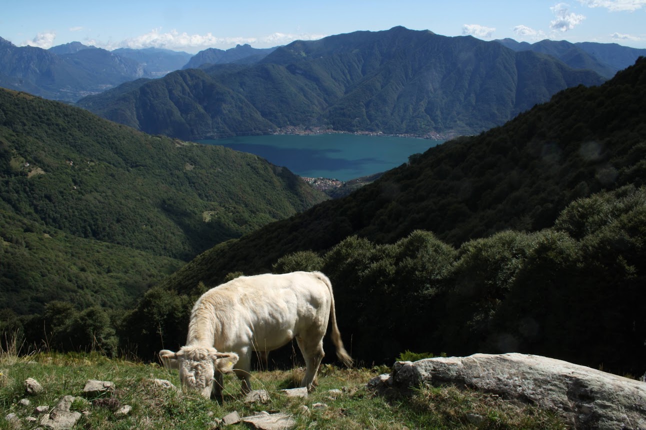
From Argegno we took the cable car up to the village of Pigra, a small village at the eastern end of the Val D’Intelvi. We thus gained 900 metres above sea level and a marvellous view down over the lake for no effort and small cost. From Pigra the walk involves a steady incline through trees before opening up to the grassy slopes of the Alpe di Colonno (at approximately 1400 metres above sea level) where we stopped at the baita for coffee and home-made tart. Here the views open up to the north and west as the military road winds gently downhill towards the Rifugio Boffalora above Lenno and Ossuccio.
After the Alpe di Colonno the path opens up to pass through extensive pastureland with the Rifugio Boffalora just out of view.
We stopped at the Rifugio Boffalora for an early lunch (merely acceptable) and the house red wine which is best avoided.
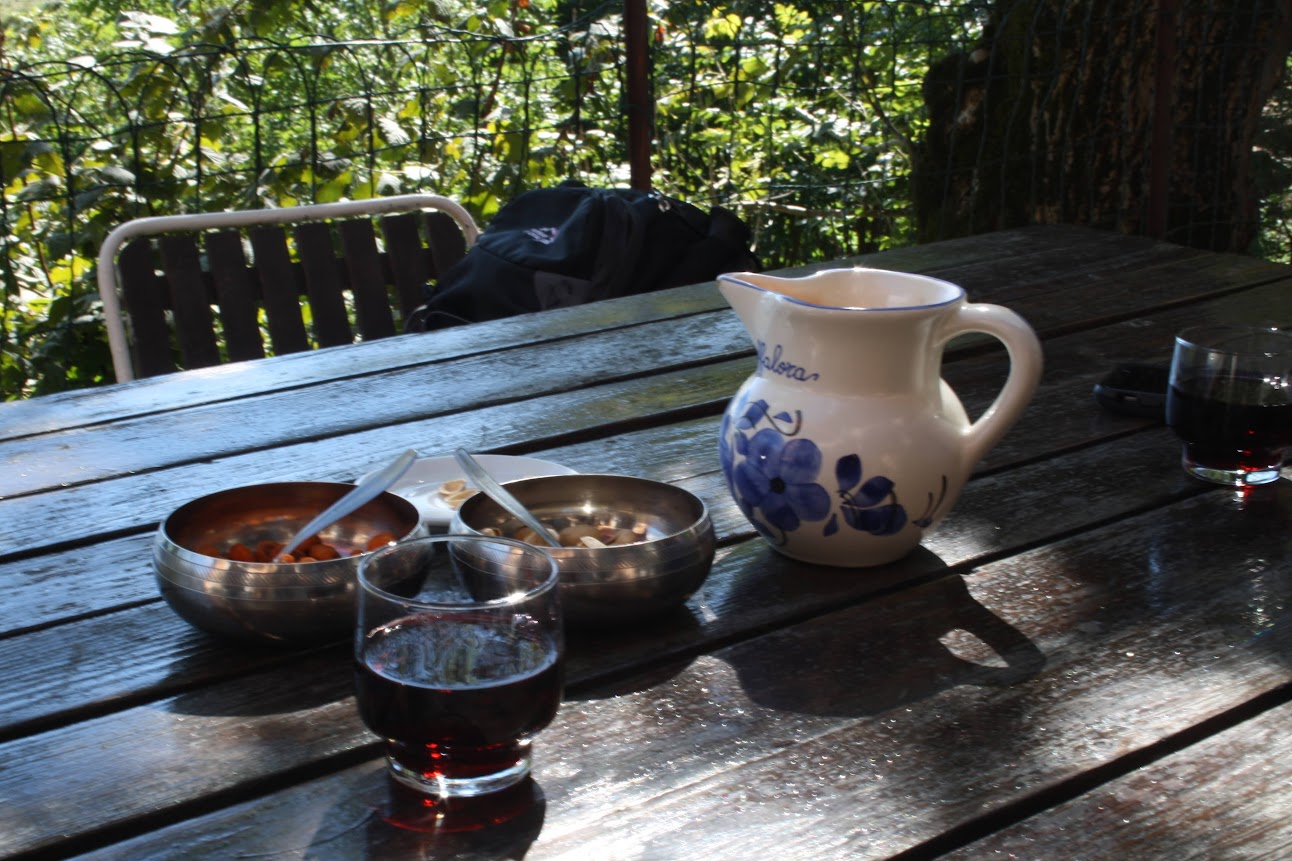
Rustic poison
One can afford to be critical over the quality of food and wine even in these remote spots because for every establishment offering something questionable there is another where the cooking will be exceptional. The proprietor did however tell us about a unique olive oil producer – a UK refugee – down the valley in Lenno whose limited production has won him prizes as far away as New York. His oil can only be bought directly from his home in Roveglio. (See Further Information for contact details).
Paths descend down from Boffalora to Lenno or to the charming ruins of the San Benedetto monastery above Ossuccio. Back in the last war, that same path down to Lenno was used by the local hero of the resistance, Captain Ugo Ricci, and his troop of partisans. Their mission was to kidnap the RSI Minister of the Interior Guido Buffarini Guidi whom they believed was staying at the Hotel Lenno on the lakefront. That ill-fated mission ended up without the capture of Guidi who was not even in Lenno on that day but with the death of Ugo Ricci caught in ambiguously accidental friendly fire.

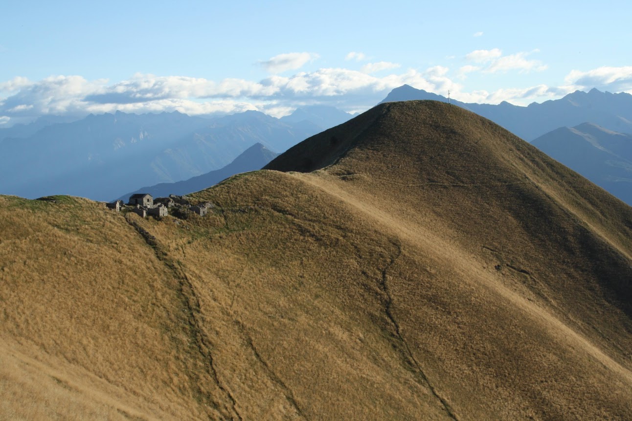
Our overnight destination is on the left of the picture just below the mountain crest
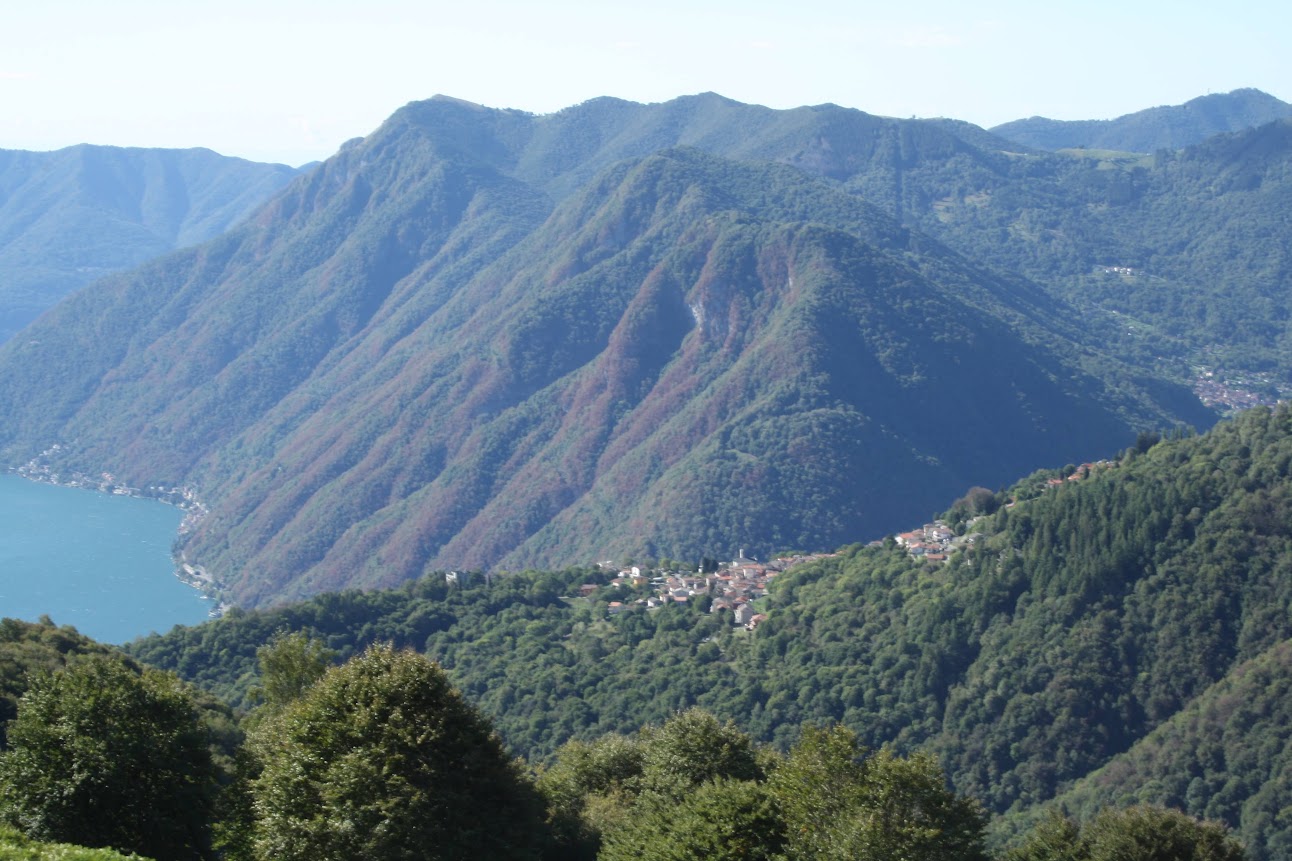
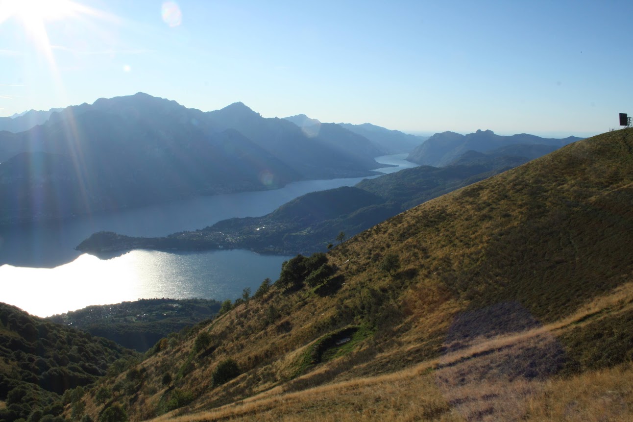
Leaving the spirit of Captain Ricci behind us, we continued on the military road towards our first day’s destination – the Rifugio Venini. This rifugio is in a strategic location just below the mountain ridge that looks down onto the valley linking Menaggio with Porlezza. The summit of Monte Galbiga (1,600m) is a short ten minutes walk behind the rifugio. From the summit, you get a view to the west over Lake Lugano and to the east across Lake Como. There are a series of robust artillery emplacements along the path, each with a strategic range across the valley. These emplacements continue along the military path such that the original line of defence would have made any attempt to invade along the road from Porlezza highly dangerous.
From Monte Galbiga there is a view down to both Lake Como and Lake Lugano, shown here with Porlezza at its eastern end.
The Rifugio is placed in the middle of an extensive alpine pasture with uninterrupted views over Lake Como. The terrace catches the sun for most of the day, and, as night falls and temperatures drop sharply at this altitude, there is a roaring fire in the heart of the dining room. The dinner here was excellent offering typical mountain food such as pizzoccheri and polenta with various sauces. And the house wine was more than acceptable. In fact, the food is so good that many of the clients seem to have made the journey there just to eat. Or so we thought…

The warm and welcoming interior of the Rifugio Venini where we sat down to an excellent dinner before a somewhat troubled night’s sleep.
An early bedtime was strangely interrupted by a repetitive techno bass line vibrating through the building. All became clear when we left early the next morning before the party goers had stirred to see a long row of mini 4x4s parked up along the edge of the military path. The rifugio certainly makes a great location for a summer party, and there are of course no neighbours to complain about noise levels. Yet in spite of our troubled night, we still left the Rifugio in a positive mood due to the quality of our evening meal and the overall splendour of the location.
Early morning sun shines from over the Grigne mountains with Bellagio in the middle distance dividing the lake eastwards to Lecco and south to Como.
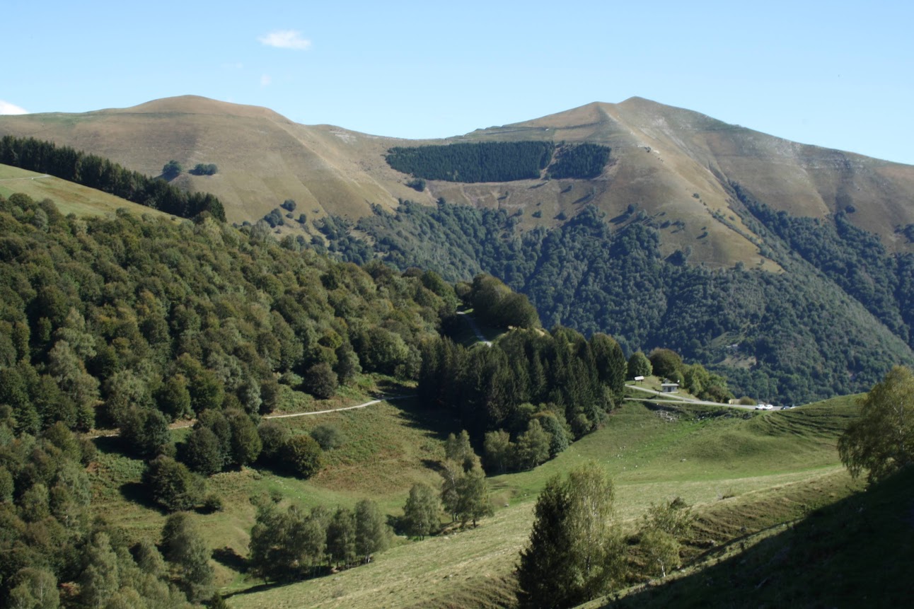
Our interrupted night’s sleep was also more than compensated by stepping out into the crisp early morning air and seeing the sun rise up above the Grigne mountains to our east. The only other early risers were a group of hunters using their dogs to raise hares from the undergrowth. However the cool air was making it difficult for the dogs to pick up the scent and for me to correctly interpret the map.
By mistakenly following the crest of the mountains we arrived at Monte Crocione shown here.
To have continued on to Menaggio by descending the north facing sides of the valley, we should have crossed the ridge at the Rifugio and counter-intuitively, taken a path starting out to our left. Instead we continued along the ridge and then confounded our mistake with a further error when we ignored a relatively narrow hiking path marked as the military road in preference for a broader path with more artillery defences pointing over the valley. Our mistake led us to the conical summit of Monte Crocione (1,700m). From here we could see Bellagio on its peninsular and the course of both the Como and Lecco legs of the lake running southwards. But the price we had to pay was a tricky descent down the immediate summit on a hiking trail no better than a goat path. This brought us thankfully down to join the military road which at this stage was no broader than a path. This path descends down to Tremezzo through a long series of hairpin bends and through a narrow man-made tunnel with the lake constantly in view as it gradually got closer and closer.

As we descended, Bellagio became ever closer
Down in Tremezzo we were in the heart of Lake Como’s most prestigious tourist area with Bellagio across the way and Villa Carlotta nearby. It was as if the early morning hunters, the sparse number of hikers on the Via dei Monti Lariani and the Rifugio Venini, even with its hedonistic clientele, occupied a different universe. Such is Lake Como where altitude is the great differentiator. A short vertical climb will soon lift you above any possible lakeside confusion even during the most frenetic weeks of the summer calendar.

Ferries and water taxis on the lake, tour buses and cars on the road – the frenetic summertime activity on the lakefront is in marked contrast to the tranquillity in the mountains.
Summary
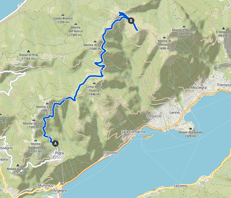
The route taken on Day 1


Route taken on Day 2
Further Information
For details of the various ‘rifugi’ in our area, go to this link.
More information on the 4 stage walk of the entire Via dei Monti Lariani is available at this link.
For more information on acquiring the prize-winning ‘Extravergine Olio di Oliva di Roveglio‘ contact Paul on 07718 785556 or write to info@lake-como-holiday-home.co.uk
Check out our section on Walks for details of other excursions in our area.