In the footsteps of Don Carlo Banfi
This is a relatively long walk that takes us from the heart of the Lario Triangle (the area between the two legs of Lake Como) in the Vallassina to Nesso on the shores of the western leg of the lake.
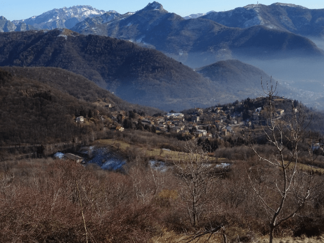
Sormano in the Vallassina seen from the Muro di Sormano
The route follows close to that most likely taken by Don Carlo Banfi when he led 16 Jewish refugees on November 2nd 1943 from Sormano to Nesso and subsequently the following day to Mount Bisbino and across the border into Switzerland. He was one of a number of locals who either led or assisted these so-called ‘viaggi della salvezza’ leading Jews as well as other enemies of the fascist state away from capture and deportation to Nazi extermination or labour camps, as described in our latest article for Holocaust Memorial Day, January 27th. Those earlier travellers would have been far too preoccupied over their safety to be able to enjoy and marvel at the tranquil sublimity of the setting for this walk as we are now free to do.

Mist rising from Lake Como looking north from above Nesso
Allow about six hours for this excursion and be warned there is one particularly arduous section walking up the renowned cycle hill climb known as the Muro di Sormano. The route follows well-established mule tracks and tarmacked road in parts but robust clothing is a must and be prepared for snow over the winter months.
I will break the walk down into four sections as follows:
- Asso to Sormano via Caglio
- Sormano to the Colma del Piano (1124 metres) via the Muro di Sormano
- Pian del Tivano
- The Valley of the Nosé leading to Nesso
If based in Como, a €3 ticket on Bus C49 will get you to Asso dropping you off at the terminal in Piazza Mercato. From here walk into the old centre and head for the Ponte Oscuro. At the drinking fountain on the other side of the bridge there is a footpath with only the left-hand fork signposted towards Monte Palanzone. This is our starting point.
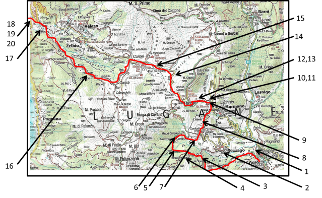
Taken from Kompass Map 1:50000 No. 91, Lake Como and Lake Lugano showing locations of the numbered photos in the article
Asso to Sormano via Caglio

Photo 1. Right hand fork from drinking fountain. Follow path to the left at this point but take all subsequent right hand forks when they occur.
You will get to Sormano eventually whether you take the right or left hand path. However the left option is signposted, is a more distinct path and passes the Agriturismo Enco and the fascinating rock formations known as the ‘Fungi di Terra’. However, as shown on the map, it is not a direct route north. The right hand option is more direct but is not signposted with a path that at times gets indistinct. If you do opt for the right hand option (See Photo 1) , your path will eventually reach the outskirts of Rezzago (Photo 2) where you should follow the tarmacked road with signs pointing to the Agriturismo Enco and the Fungi.
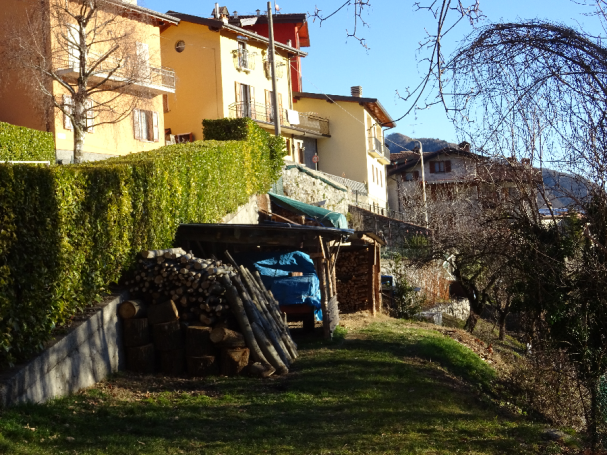
Photo 2. Outskirts of Rezzago
Whichever option taken, you will converge at a junction just before the so-called ‘Castagneto di Enco’ which is easily recognisable by the signposting and the hut maintained by the Alpine Club shown in Photo 3.
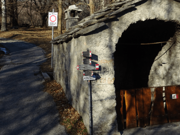
Photo 3: Junction to Caglio. Turn right if coming from Rezzago or left if from Enco and the Fungi di Terra.
Take the path in the direction of Caglio (a right hand turn if arriving from Rezzago and a left turn if coming from Enco and the Fungi di Terra.
The Castagneto di Enco (Photo 4) is a flat area totally populated by chestnut trees. As you walk towards Caglio you then pass the the Jungle Raider Park Xtreme (Photo 5)! Jungle Raider describes itself as ‘…the first extreme adventure park in Italy, with 7 stunning attractions to be addressed in sequence. Great steps with height of 60 meters and ziplines with a length of 130 meters, to take proof of your recklessness.’ This is followed by the calmer Sanctuary of the Madonna of Campoé (16th century in origin – Photo 6).


You now join the tarmacked road and enter into Caglio past the cemetery with the first clear view of Monte Grigna in front of you (Photo 7). Turn left at the junction before arriving in the town centre and then turn left again on to Via Santa Valeria which soon downgrades to an indistinct and unsignposted footpath. Head out in the direction of the church tower of Santa Valeria (Photo 8) to your right.

Photo 8. Santa Valeria outside of Sormano
When you re-emerge onto the tarmacked road, turn right and descend down by keeping to the left into Sormano. The turning for the start of the next section (the gruelling climb up the Muro di Sormano) is on your left before you enter the town centre.
Sormano to the Colma del Piano via the Muro di Sormano
I’ll describe this section as if you are starting from Sormano (or have decided to enter the town for sustenance before taking on the aforementioned and dreaded Muro).
Head out of Sormano on the Via Santa Valeria turning right where you see the junction shown in Photo 9. Turn off the tarmacked road onto the well-defined path following the course of a river on its left (Photo 10 and 11).
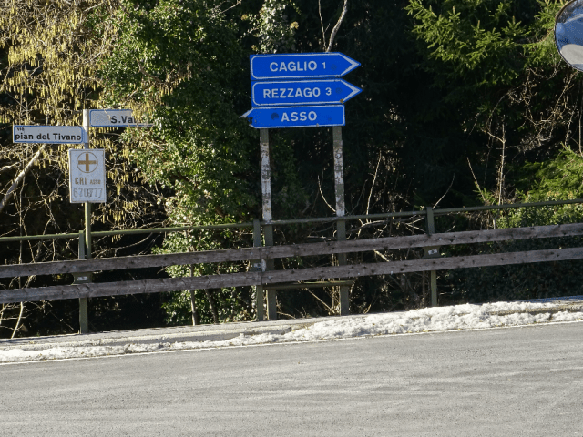
Photo 9. Via Santa Valeria – the road out of Sormano
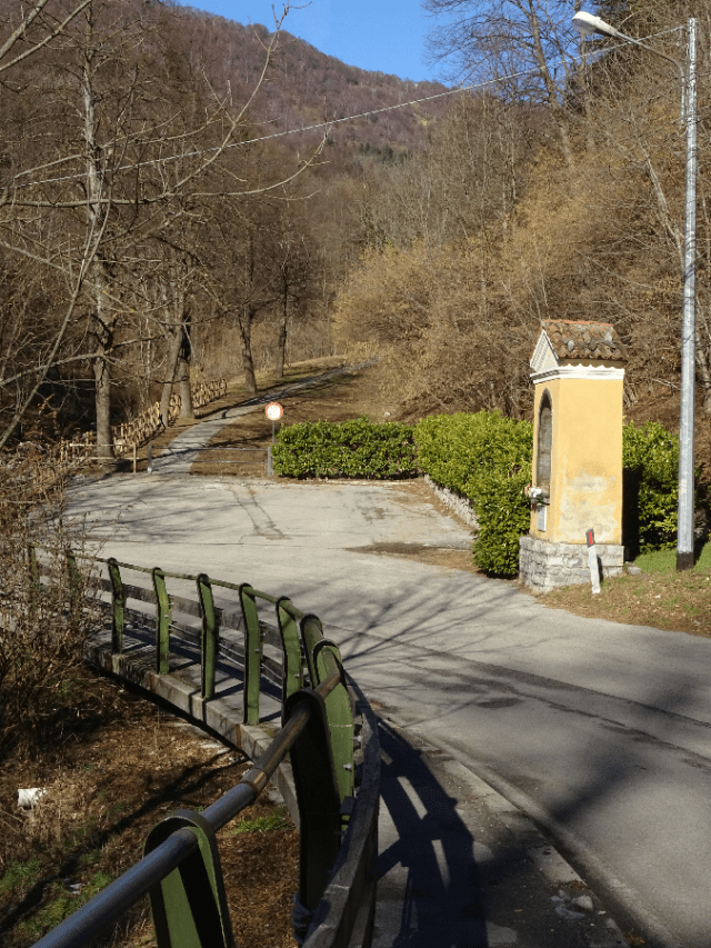
Photo 10. Start of the path up to the Muro di Sormano
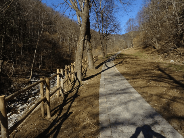
Photo 11. The walk up to the Muro di Sormano following the river valley
You soon rejoin the tarmacked road which crosses the river and starts its inexorable climb up to the Colma del Piano. This is the Muro di Sormano known throughout the cycling community as one of the most gruelling climbs on any cycling circuit. The statistics state the climb has an average gradient of 17% rising to a maximum of 25%. Over its 1.7km length, we will climb 280 metres with each metre gained marked on the road (Photo 12).

Photo 12. Metre height markings on the Muro di Sormano for cyclists as they make this 1.7km climb.
Cyclists take a seemingly masochistic pleasure in climbs such as this and they do not even have the chance to stop and admire the views as their leg muscles burn under the unrelenting pressure of the incline. We instead are free to stop and admire Monte Grigna or to simply catch our breath (Photo 13).

Photo 13. Monte Grigna seen from the Muro di Sormano
At the top we reach the Colma del Piano with its Trattoria Bar and Observatory at 1124 metres above sea level – the highest point of our walk. In fact, from this point on our walk is either downhill or on the level.
Pian del Tivano
We keep to the main road to cross the Pian del Tivano, a flat area at about 900 metres above sea level on the southern side of Monte San Primo (1600 metres). As Don Banfi led his refugees down the hill from the Colma del Piano, they would have got a first glimpse of Switzerland looking west to Monte Generoso and the promise of safety (Photo 14).

Photo 14. Descent to the Pian del Tivano with Monte Generoso in Switzerland in the far distance.
At the time of Don Banfi, the Pian del Tivano was where one of the first groupings of armed partisans gathered under the leadership of former army officers unprepared to serve under an illegitimate regime. However they soon had to retreat further into the mountains due to the vulnerability to parachute attack on such a flat terrain.
Keen potholers may want to explore this area further due to the access it gives to kilometres of underground caverns and water courses carved through the chalk rock. Others may well want to take advantage of the numerous bars and restaurants which bear testimony to the popularity of this area for visitors. In the past, when winters were more severe, there were even skiing installations on the slopes of Monte San Primo (Photo 15). Nowadays these only exist on the colder northern facing slopes of the mountain looking towards Bellagio.
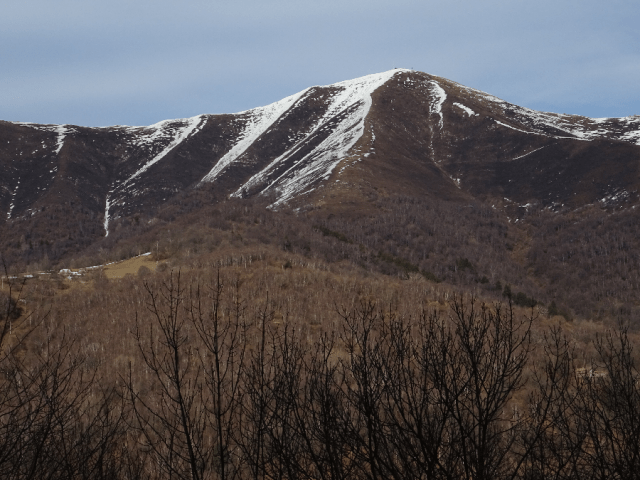
Photo 15. Monte San Primo’s (1600m) southern slopes. There are still some skiing facilities but only on the colder north facing side of the mountain.
As we come to the far end of the Pian del Tivano, once having passed a road off to the right signposted to Véleso, we take the next tarmacked road to the left and start out on the last section of this walk.
Following the Nosé Valley to Nesso
This section is not signposted until you get relatively close to Nesso but you cannot go wrong if, wherever faced with a fork along the path, you always take the right hand option. Gradually the tarmac gives way to cobble and the descent towards Nesso gets steeper. All along the way, we get glimpses of the hill side settlements of Véleso and Zelbio (Photo 16) on the slopes of Monte San Primo as we walk along the heavily wooded valley.

Photo 16. Zelbio and Veleso seen from the other side of the valley beyond the Pian del Tivano
As the descent gets steeper, we also begin to hear the sound of the gushing torrent which has cut a deep gorge whose sides get ever steeper as the valley closes in. The climate also gets milder as the influence of the lake makes itself felt (Photo 17). Once we cross a stone bridge (Photo 18) it is not long before we reach the outskirts of Nesso (Photo 19) and continue down to the main road between Como and Bellagio at the Piazza Castello.


From here there is a good view of Nesso’s waterfalls, the Orrido di Nesso (Photo 20) or down to the lakefront and Nesso’s famous medieval bridge that spans the Nosé as it enters the lake.
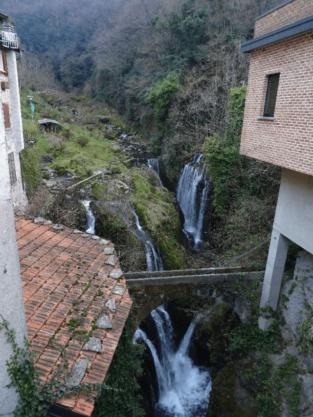
Photo 20. The Orrido di Nesso (Waterfall), seen from the bridge on the main road off the Piaza Castello.
From Piazza Castello you can return to Como by bus C30 or walk down to the lakefront to catch one of the boats from the jetty.
