

The view from the Rifugio Bugone down on to Lake Como.
This walk, from lakeside to the crest of the mountains on the Via dei Monti Lariani and then down, is rewarding but not for the fainthearted. The first section climbing up from Carate and past Monte di Urio requires stamina but the well-defined path offers changing views over the lake as you climb higher. You are at your highest altitude when you reach the Colma del Crinco to join the old military road which now forms the Via dei Monti Lariani. We turn left here to enjoy a level walk to the Rifugio Bugone. From the rifugio we descend down to Moltrasio following the old smugglers’ route now used for an annual alpine running competition described as a ‘killer’ and called La Culman. This is a route favoured with nearby mountain retreats offering food, drink and accommodation. You can easily divert from our suggested route to the Rifugio Murelli or to the Vetta Bisbino. You can also make this a circular route by following a small section of the Via Verde through the narrow streets of Tosnacco back to the Santuario Santa Marta in Carate.

La Culman is a particularly tough annual alpine running competition ascending the path on which we descend, but then continuing back down to Moltrasio only to climb again to the Rifugio Murelli.
Starting Point, Santa Marta in Carate Urio

If arriving at the lakeside, take the Via Santa Marta shown here with its Via Crucis which goes under the main road and ends at the Sanctuary of Santa Marta.
The steepest section of the walk is the old smuggler path called La Culman which reaches a 70% gradient towards the Rifugio Bugone. I prefer to descend rather than climb such steep slopes so I chose to start the walk from Carate Urio and end it by following La Culman down to Moltrasio. So, taking either Bus C10 or C20 from Como, you can either get off at the San Marta bus stop if you are on a ‘via panoramica’ bus (the route that keeps to the high road up from the lakefront) or at the Urio Genesio bus stop down on the lakeside. The Santa Marta Sanctuary is on a slight promontory looking south towards Como and surrounded by an olive grove on well maintained terracing. Head out south on the so-called Via Verde which is marked out by painted green spots on the stone paving. After at most ten minutes you cross a mountain stream that flows down to the Church of San Quirico and Giulitta in Urio and you arrive at the gates of the Urio Cemetery. Facing south and to the right of the cemetery’s entrance are two paths. The one on the level is the continuation of the Via Verde while the other rising steeply to the right is our path going to Monte di Urio.
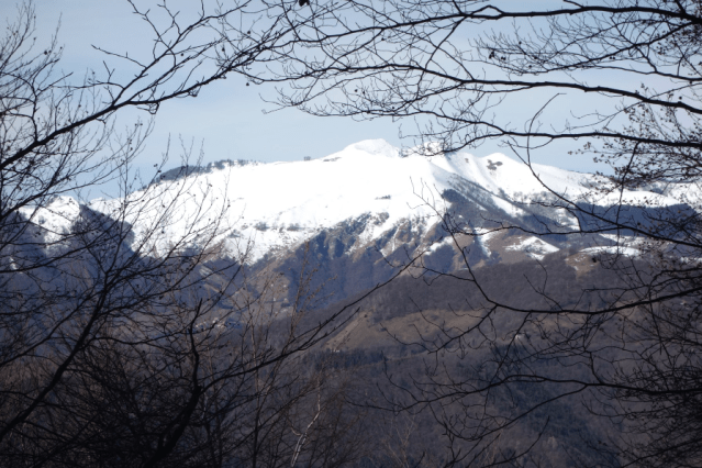
Climbing to Monte di Urio

Signposts direct you off the Via Verde to start your ascent to the right of the Urio Cemetery.
The path to Monte di Urio is steep but well maintained passing through woods which provide shelter from sun in summer and views over the lake in winter. You arrive after one hour of hard climbing at the small alpine community of Monte di Urio, 800 metres above sea level. From here there are marvellous views to north and south along the lake. Paths diverge at the small chapel at the heart of the village with the option of taking the direct path to Rifugio Bugone on the left or to carry on to the Colma del Crinco by following the sign for the Rifugio Murelli.
The route towards Rifugio Murelli is possibly less steep overall than the climb up to Monte di Urio but it is still somewhat challenging in parts. However, after following the path north for about 2 kilometres, you make a decisive turn to the left and will then see that you are not too far from the crest of the mountain. It comes as quite a relief to reach that crest and, leaving the view of the lake behind you, look over towards the twin peaks of Monte Generoso and Switzerland.

The alpine village of Monte di Urio is 800 metres above sea level.
You are now on the old military road now called the Via Dei Monti Lariani, a long distance hiking path that starts from Monte Bisbino and continues along the Val D’Intelvi before crossing the valley to continue on to the north end of Lake Como.
Once on the Via dei Monti Lariani your views are over towards Monte Generoso, the Sasso Gordona and the Swiss Alps.
Via Dei Monti Lariani

You join the Via dei Monti Lariani at the Colma del Crinco at 1,160 metres above sea level. Turn right for a 20 minute walk to Rifugio Murelli or left in a slight descent to the Rifugio Bugone.
There is the option on reaching the Colma del Crinco of turning right and continuing for around 20 minutes to reach the Rifugio Murelli. This rifugio was, like Rifugio Bugone, one of the string of barracks built to house the guards deployed to prevent smuggling (somewhat unsuccessfully) across the Swiss border. They were occupied by members of the Guardia di Finanza, many of whom actively helped Jews, partisans, allied soldiers and others escape across the border during the last war. They now offer walkers with food, drink and accommodation but it is advisable to check if they are open before setting out if hoping to stop for refreshment. Murelli is usually always open but call +39 335 843 4493 to be sure.
The Colma del Crinco is at 1,167 metres above sea level which is the highest point on our walk. If you were to divert to the Rifugio Murelli, you would only climb a further 33 metres but if you turn left rather than right towards Rifugio Bugone, you will descend by 50. The path is well maintained and clearly signposted taking you through woods that offer views over to the Sasso Gordona and Monte Generoso on your right before arriving at the Rifugio Bugone.

The Rifugio Bugone is open all week during the summer and at weekends through the rest of the year for food and drink. You are however advised to use the contact information to check on opening before setting out on your walk.
The Rifugio is open every day during the summer but only at weekends for the rest of the year. However, it is always best to contact them to check either by emailing stones roberto.rifugiobugone@gmail.com or calling +39 031 0350027.
The views from Bugone point down again over Lake Como. The Rifugio is on a hiking crossroads with the option as you face the lake of taking a sharp left turn down to Monte Liscione before reaching Tosnacco. You could also continue on the Via dei Monti Lariani to Monte Bisbino or take the path between these two options signposted for Monti di Lenno. For our route, we start off by taking this latter option.

Look out for the yellow markers on stone and tree that mark the start of the La Culman trekking path leading left off the path for Monte di Lenno. If conditions are slippery, I advise you continue to descend via Monte di Lenno.
Descent to Moltrasio on La Culman

The route of La Culman marked out for the annual alpine running challenge starting off in Moltrasio.
As you follow the path signposted for Monte di Lenno, look out after about 150 metres for yellow painted stones that mark the start of the steep descent to Moltrasio on the old smugglers’ path known as La Culman. This path is particularly steep at the start of the descent and is far from being well defined. However the way down through the rocks is clearly marked out with splashes of yellow paint. These markings are designed particularly for the competitors in the annual alpine running competition. This race, openly described as a ‘killer’, takes place in October with runners ascending from Moltrasio up to Bugone through the trees and the rocks following a route used by local smugglers in the past. The yellow markings are designed for those climbing rather than descending so, if you find yourself unable to pick out the next marking, just look back to orientate yourself.
 The path gradually becomes more clearly defined as it eventually joins a disused mule path. This in turn leads you down to the southerly end of Tosnacco on Via Colombo from where you can either descend further to Moltrasio or continue north on Via Colombo to go through the labyrinth of Tosnacco’s narrow streets towards the Via Verde. Follow this to return to your point of departure at Santa Marta in Carate. Another option is to turn right on arriving at Via Colombo to pick up the Sentee di Sort which starts close to this point and continue walking on to Rovenna above Cernobbio.

The Sanctuary of Santa Marta in Carate seen from the Via Verde as you return from Moltrasio,
To return to Como you can take your luck finding a C10 bus at the bus stop across from the pharmacy on the main road or increase your options by going down to the imbarcadero on the lakeside. Here you can choose either the bus or the boat to get home.
Returning to Santa Marta

The Church of Saint Quirico and Giulitta in Urio looking down from the Via Verde. It’s possible to see Como’s Villa Olmo in the far distance just to the right of the bell tower.
The time added to the route for returning you to your point of departure is not included in the summary below. You will however be pleased that the additional two kilometres are not onerous since the Via Verde is mostly on the level. It also takes you through the delightful medieval centre of Tosnacco before continuing on a path paved with Moltrasio stone around the headland to Carate.
Summary

Distance: 8.6 Kilometres
Time: 4 hours 10 minutes
Climb: 900 metres
Descent: 1000 metres to the lakeside
Difficulty: Good fitness required and sure-footedness. I do not recommend descending on La Culman if the ground is wet.

Note the sharp gradient at the start of the descent. An alternative descent is to stay on the hiking path for Monte di Lenno from the Rifugio Bugone.

View as you descend the La Culman path of Torno across the lake and Moltrasio in the foreground.


